Not sure what today’s UV index means or how to protect yourself? This guide explains how to read the UV Index map, how UV exposure affects your skin, and how to stay safe outdoors.

The National Weather Service provides a UV Index forecast—an essential tool in understanding UV levels by location. If you’re wondering how to read a UV index map, you’ve come to the right place. Simply input your zip code, and you can view the hourly and daily UV Index forecast for your area. In addition to the UV Index scale, you can also reference UV Index maps, which show the different levels of radiation by location in a color-coded format. Below, we delve into greater detail about the UV Index scale and how to read a UV Index map.
What Is the UV Index and Why It Matters
The UV Index is a scale from 0 to 11+ that indicates how strong the sun’s ultraviolet radiation is. Being aware about the UV scale helps you avoid overexposure, sunburn, and long-term skin damage.
By understanding your local UV Index rating, you can make safer decisions about sun exposure. This scale is a powerful tool for preventing skin damage and skin cancer.
UV Index Map Explained
If you want to view the UV Index map for the United States, go to the UV Index on EPA.gov. There, you’ll see UV Index maps for the whole country—each displaying UV forecast values by region. These values correspond with the UV index scale, a key guide in UV radiation awareness. The map shows the predicted UV Index values during the solar noon hour for each day. Below the map, you’ll find the UV Index map key; these values are based on the UV Index scale and each number corresponds to a different color. The higher the number, the greater the UV radiation.
UV Radiation by Region
On a UV index map of the U.S., especially around solar noon, UV radiation by region is color-coded—use the UV map color chart to interpret these zones. This is critical for understanding the UV index by state and how UV levels vary by location.
Northern states are usually shaded in light orange, yellow, light green, dark green, and blue. These colors on the UV exposure map correlate to higher UV radiation exposure in the southern regions vs. lower UV radiation exposure in the northern regions.
If you were to look at a world UV Index map, you would notice higher levels of UV radiation in regions that are consistently warmer, such as the regions around the equator. The UV Index Scale is 1-11+, and in countries that are close to the equator, it’s not uncommon for the UV radiation level to be as high as 20.
At or near the equator, the sun’s rays have a shorter distance to travel to Earth. Less radiation is absorbed by the atmosphere, which contains ozone — a natural sunblock for Earth. This means that countries near the equator experience higher levels of UV radiation—in fact, some hold the record for the highest UV index in the world. These include Australia, New Zealand, Peru, Bolivia, Chile, and Argentina, where UV exposure poses significant skin cancer risks.
UV Radiation Q&As
The UV Index provides a forecast for each state. The forecast map shows each state’s UV Index values during the solar noon hour for up to four days.
Southern states, California, and Hawaii are closest to the equator and usually have higher UV Index ratings compared to other states.
No, UV radiation is at its strongest at the equator, but decreases the further north or south from the equator you travel. Northern U.S. states, for example, have lower UV Index ratings than southern states, because they’re further from the equator.
Yes, UV levels are often higher at higher altitudes due to thinner atmospheric protection. If you live in mountain regions, refer to the UV forecast daily and review the UV index scale to guide your UV protection habits. In fact, according to the American Cancer Society, states like Utah and Colorado tend to have a high UV Index rating compared to other states, because they have a higher altitude.
UV Index Scale
Again, the UV Index scale is 1-11+. So, what does the UV Index rating mean for your area on any given day? Here’s a breakdown of the UV Index scale, and how you can better protect your skin from harmful exposure:
- 0-2 is Low: You can safely enjoy being outdoors. (Sunscreen is always recommended for when you’re outside.)
- 3-7 is Moderate to High: Wear sunscreen and seek shade during midday. Protective clothing is also recommended, such as a wide-brimmed hat and sunglasses.
- 8-11+ is Very High to Extreme: Generously apply sunscreen and take extra precautions. Wear protective clothing, and avoid being outdoors during midday.
Do you want to look more closely at the UV levels for your area at solar noon? Enter your zip code into the EPA UV Index tool to the right and click the green magnifying glass. You’ll be taken to a page that covers the hourly and daily UV Index forecast for your area so that you can plan your outdoor activities accordingly.
Pay Attention to Your Shadow
There’s an easy way to get a feel for how much UV radiation exposure you’re getting: look at your shadow. Generally, if your shadow is taller than you (which is common in the early morning and late afternoon), UV exposure is lower. On the other hand, if your shadow is shorter than you (around midday), UV exposure is higher and you should protect yourself. This method doesn’t give you an exact measurement of UV radiation like the UV Index scale, but it’s a good way to gauge your surroundings when you’re outdoors.
Daily UV Index Tips to Prevent Skin Cancer
Want to stay safe year-round? Use our tips to interpret the UV index map, understand the UV scale, and apply proper sun protection. Regularly checking your local UV forecast can help you stay aware of sun radiation intensity and take necessary steps to prevent sunburn and reduce the risk of skin cancer.
Learn More from GentleCure
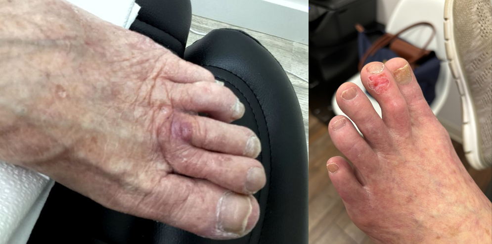
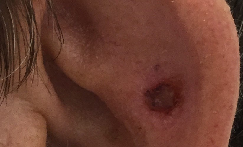
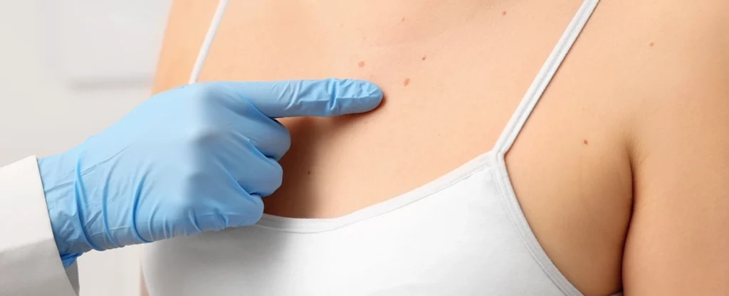
Checking the UV Index daily and taking the necessary precautions before leaving your home is a good way to help lower the risk of developing skin cancer, as well as sunburn and premature aging. If you have any questions for our skin cancer information specialists about prevention and treatment, contact us to learn more.